Proposals
Key information about the site
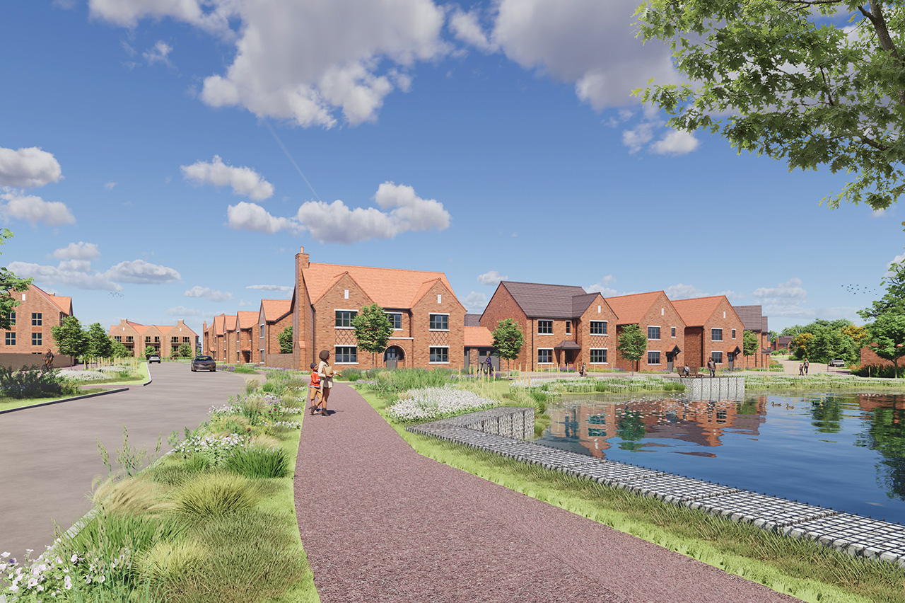
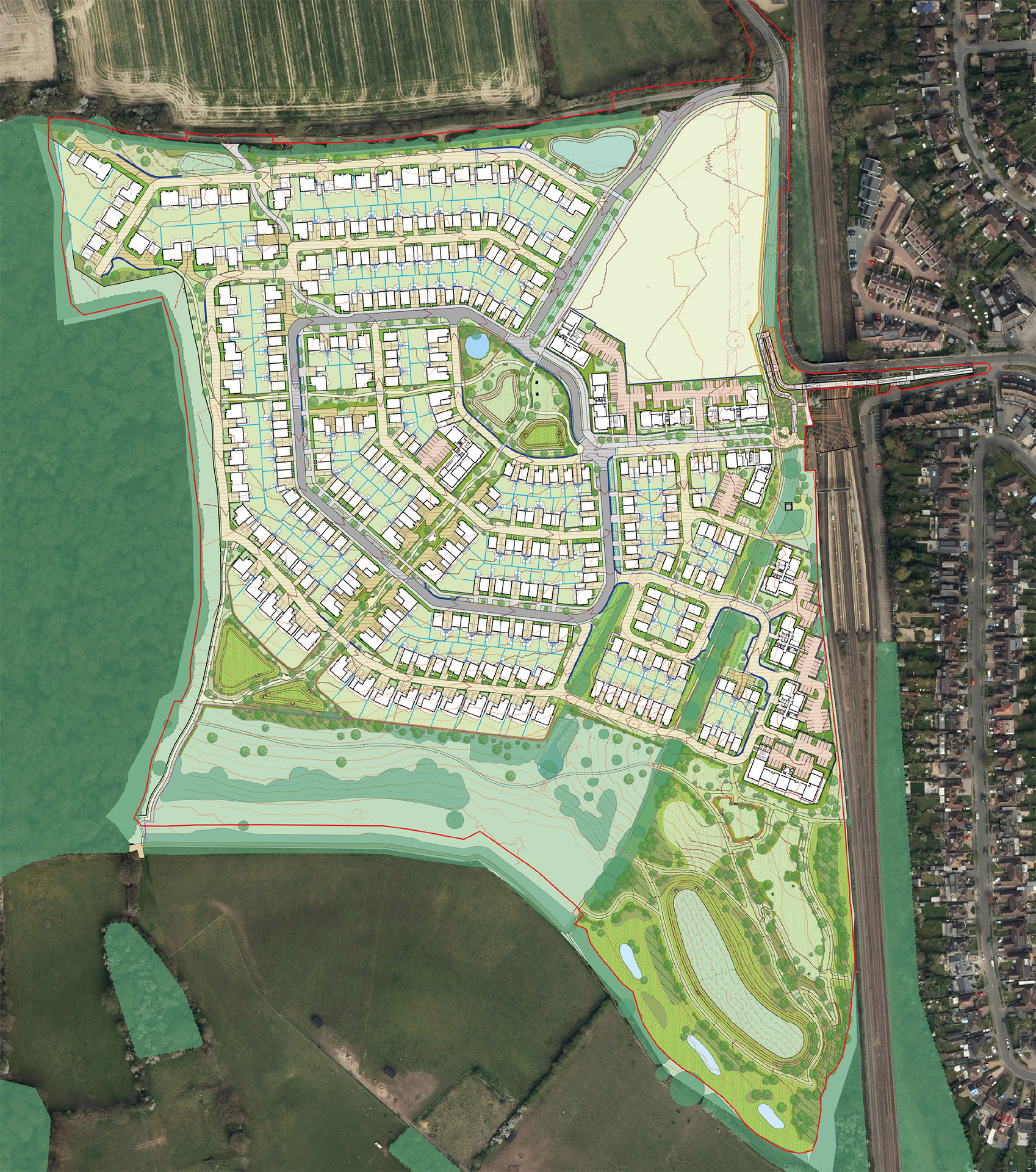
The site will provide 437 new market and affordable homes, safeguard land for a new two-form entry primary school, deliver new open spaces, biodiversity enhancements and provide a new pedestrian/cycle bridge across the East Coast Mainline (ECML).

Engagement to date
Community consultations
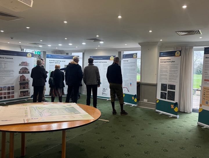
A significant amount of consultation has been undertaken with the local community to understand views and gather feedback to help shape the proposals for land west of Brookmans Park Railway Station.
July 2024 – Community consultation event
View exhibition banners (PDF)
January 2025 – Second community consultation event
View exhibition banners (PDF)
In addition to engagement with the local community, we have engaged with local community and political stakeholders throughout the plan making process to help inform the designs where possible.
Proposals
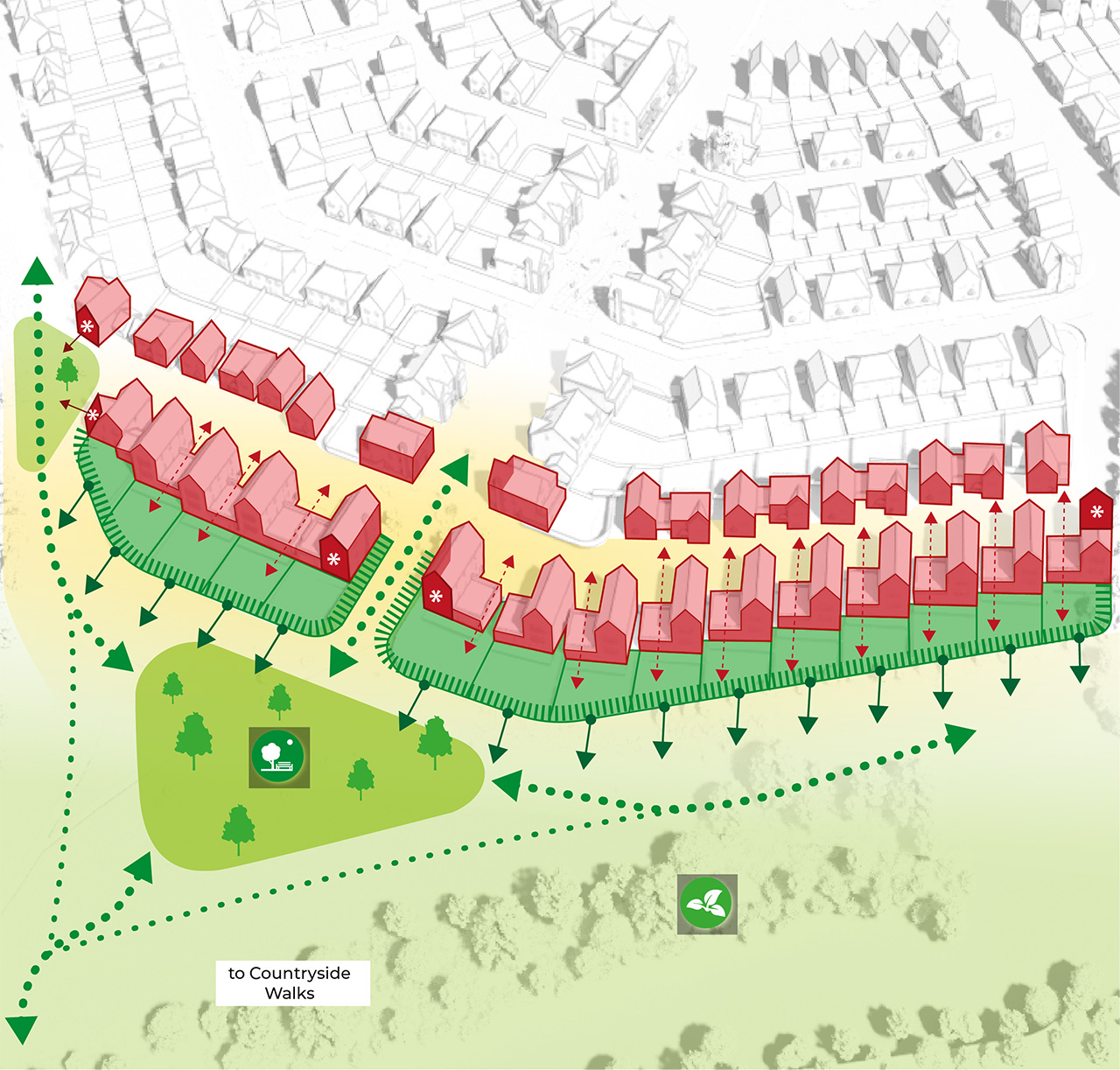
Illustrative masterplan
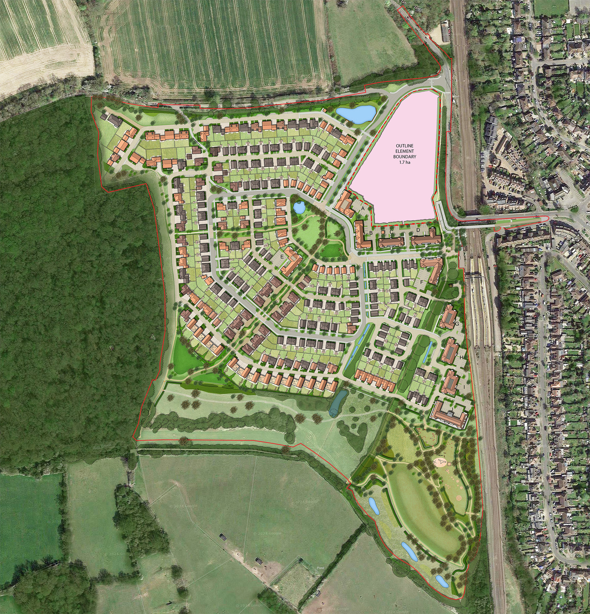
 Red line boundary
Key features
Proposals have been developed to meet the Local Plan objectives
As a result of the feedback received from the local community and the Council, the current proposals include:
New homes
A range of sizes for individuals and families
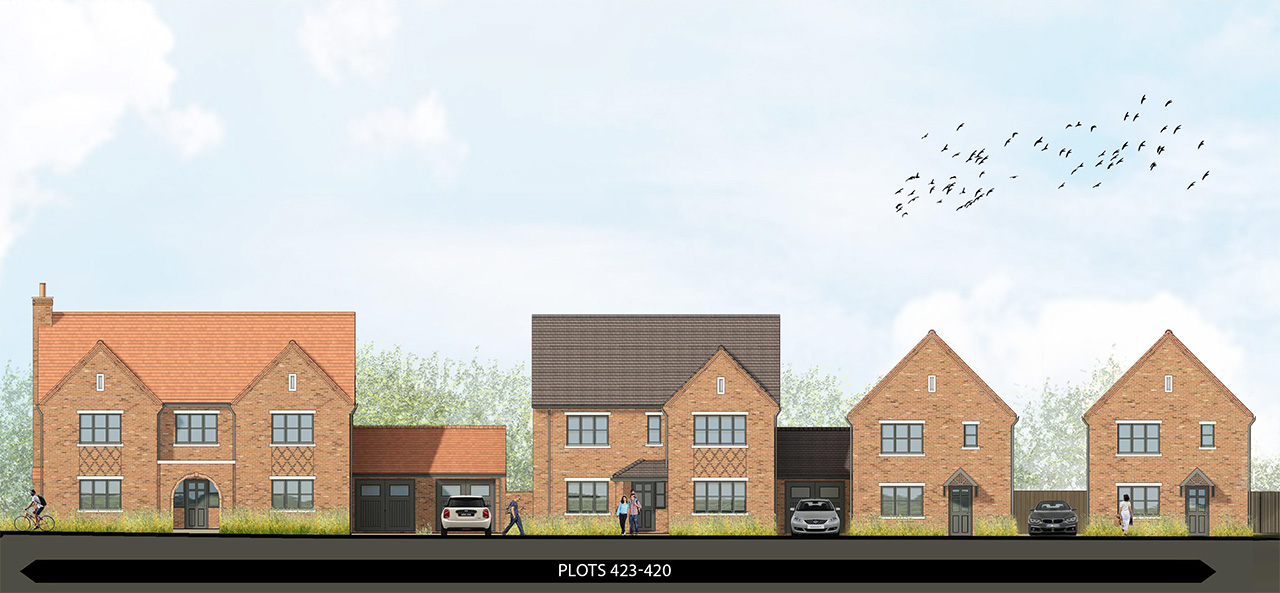
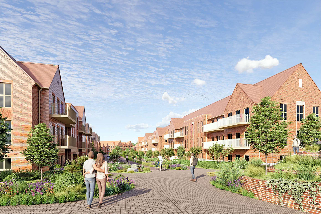
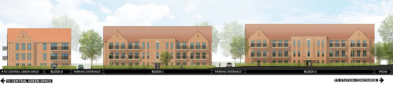
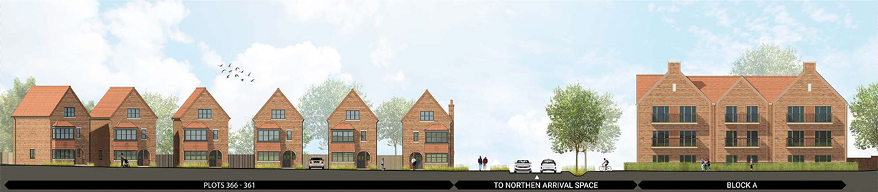
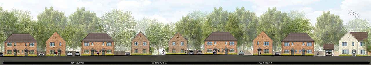
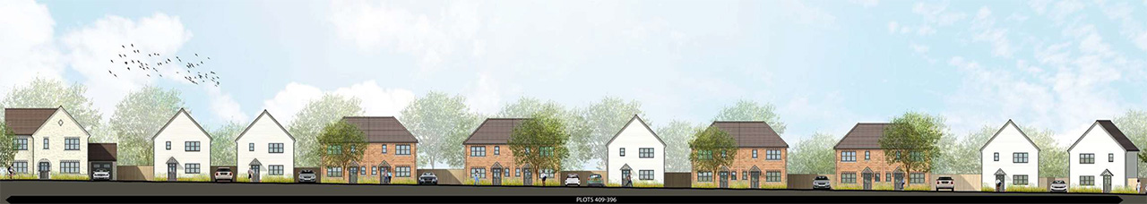
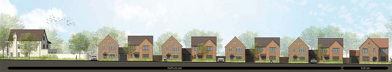
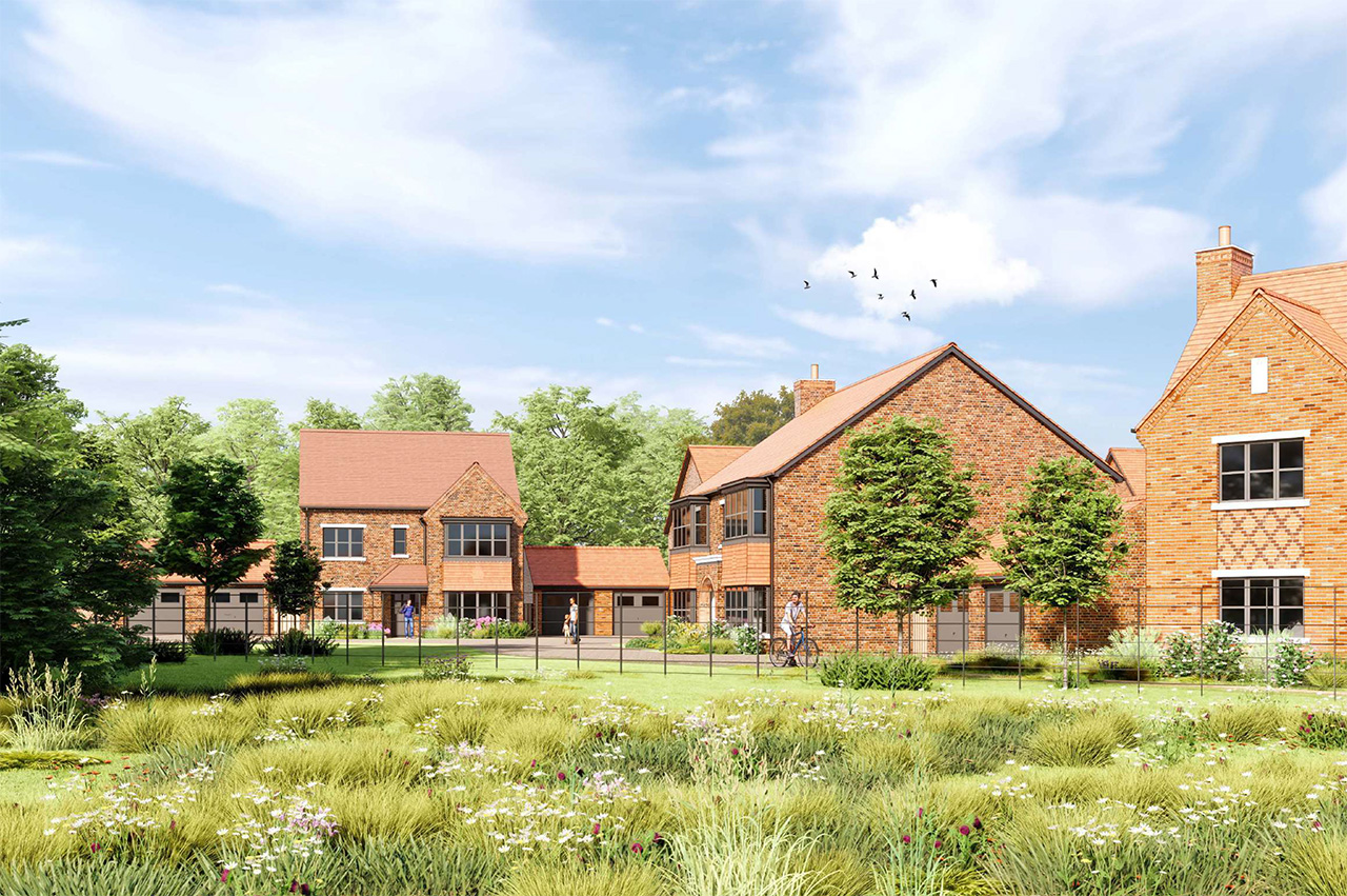
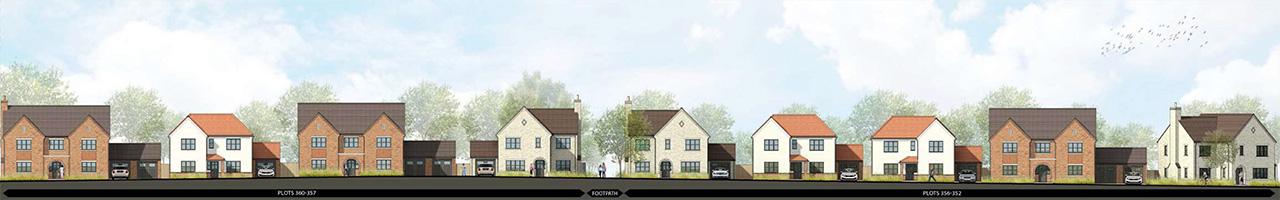
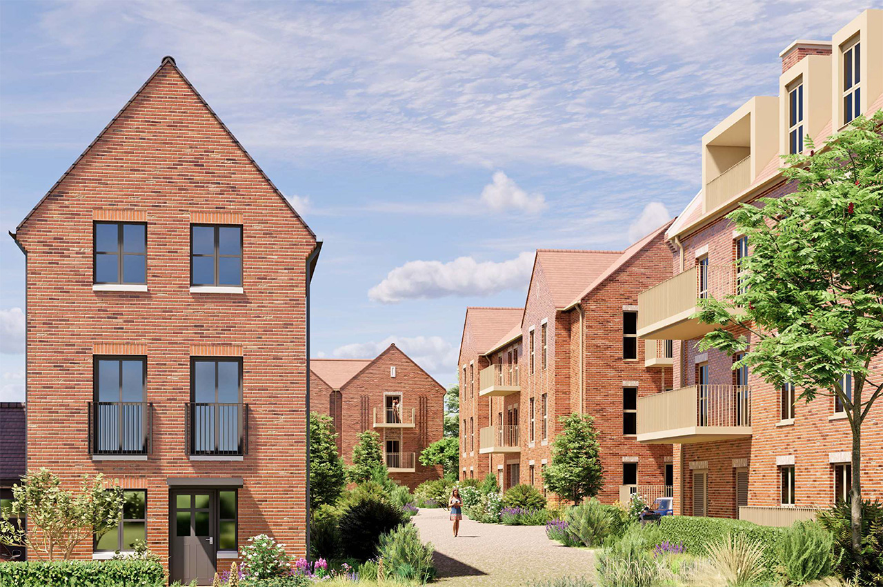
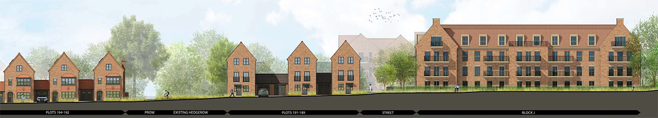
The proposals offer a diverse mix of 273 houses and 164 apartments across a range of tenures, designed to meet the needs of all demographics. The development includes one-, two-, and three-bedroom apartments distributed across ten apartment buildings, as well as a variety of house types ranging from two- to five-bedroom homes. Most houses are two storeys, with selected two-and-a-half and three-storey types located in key areas to provide visual interest and variety.
The site layout has been carefully designed to address potential overlooking issues, ensuring appropriate back-to-back and back-to-side distances to maintain privacy for residents.
The scheme also includes 35% affordable homes, thoughtfully integrated throughout the development. These consist of one- and two-bedroom apartments and two-, three-, and four-bedroom houses, providing a broad range of options to suit different household needs.
Additionally, five self-build plots are included, allowing future homeowners the flexibility to customise layouts and finishes to suit their individual preferences.
To help establish different areas within the scheme and help with placemaking, the following character areas, which follow the principles established in the Strategic Framework, are proposed:
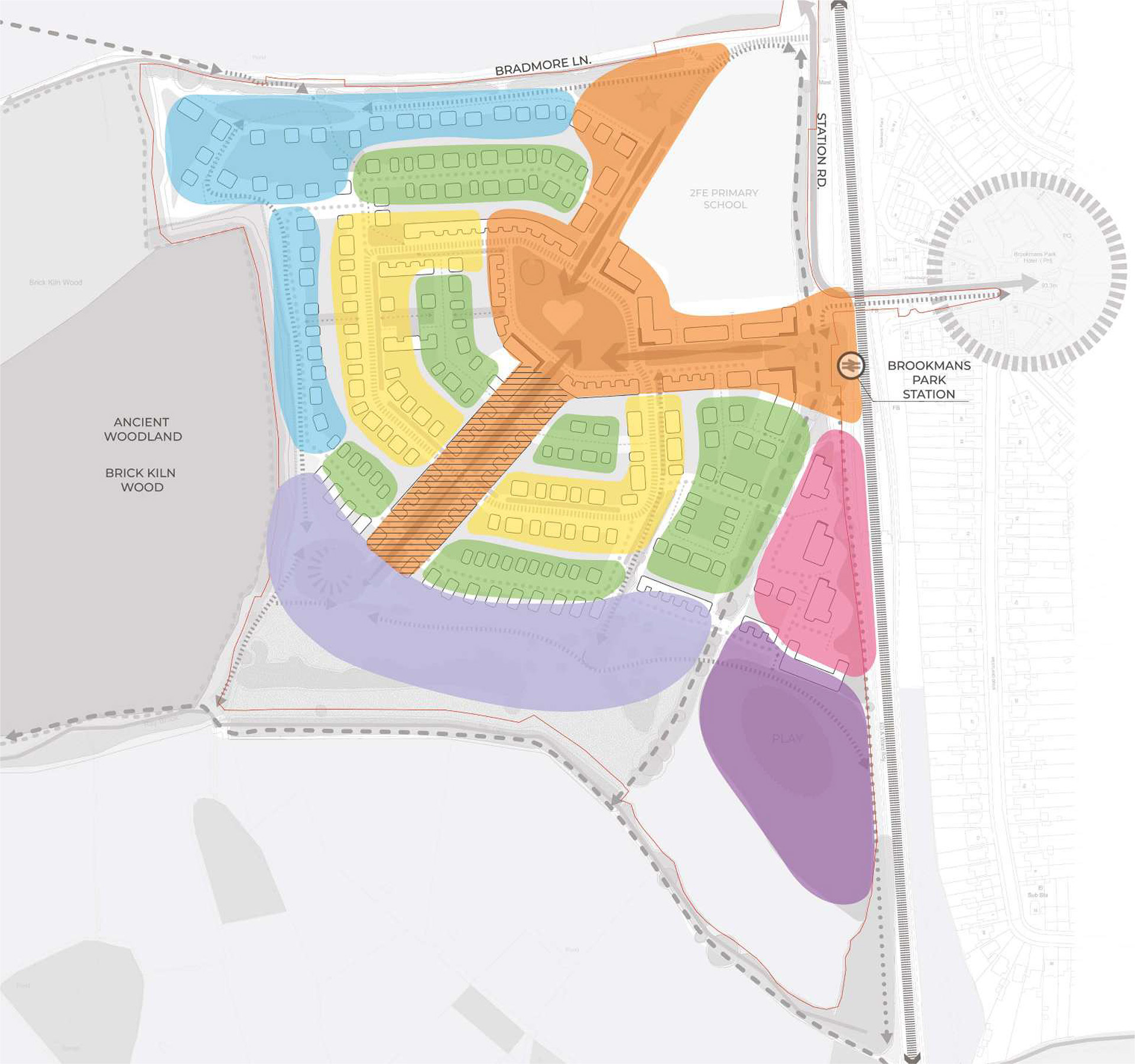
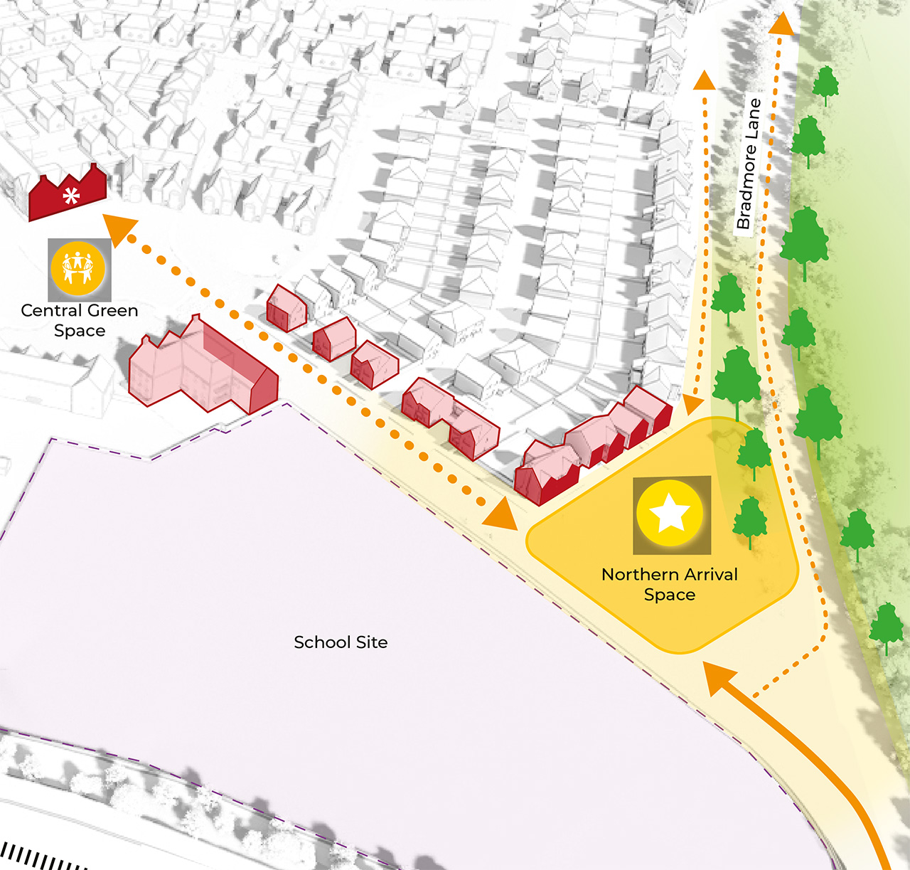
1. From Bradmore Lane
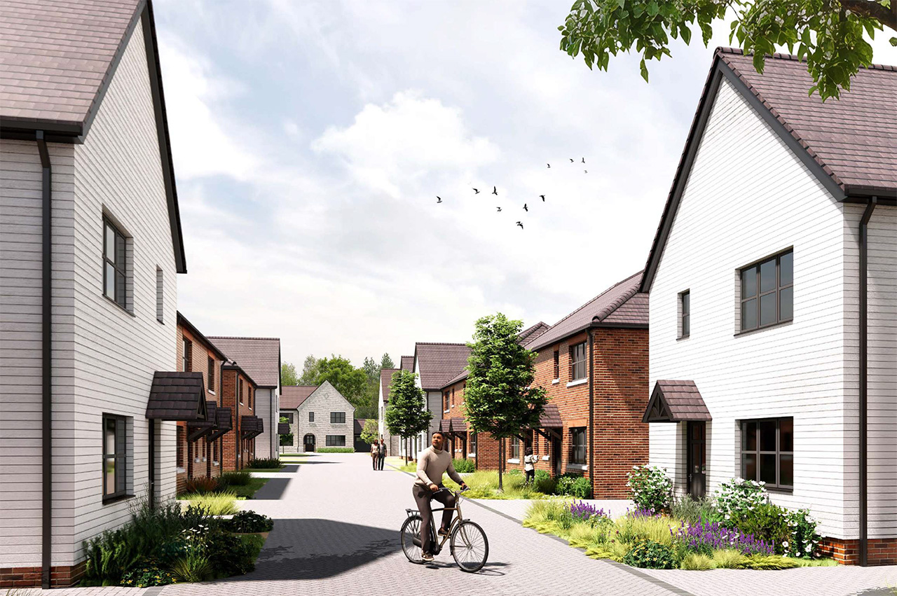
The entrance from Bradmore Lane forms a green, welcoming gateway into the development. Two-storey homes frame the approach, reflecting the rural character of the lane. A generous main street leads from this point towards the heart of the scheme, incorporating swales, street trees and a segregated cycle route. The alignment draws views southwards to a landmark building and the central green space.
2. From the Railway Bridge
A second arrival point is created where the rail bridge meets the development and station, forming a dedicated pedestrian and cycle gateway from Brookmans Park and the station. Terraces, steps and new planting provide a sociable, accessible space. Building forms, entrances and detailing have been designed to create identity and character, with varied setbacks ensuring a welcoming entrance and natural surveillance.
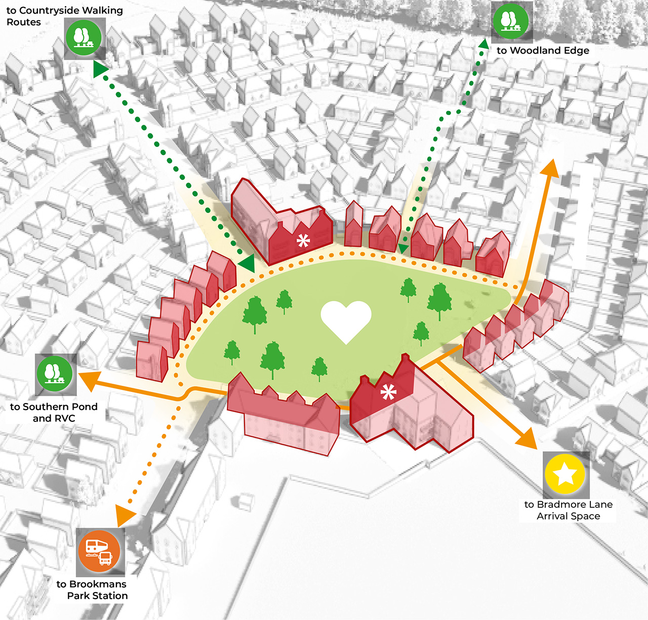
3. Main green open spaces
The central green sits at the meeting point of key routes within the development. Gabled homes and landmark buildings frame this open space, creating a strong sense of enclosure and identity. Architectural features such as bay windows, balconies and chimneys overlook the green, providing activity and ensuring it is well-supervised. The architectural language here draws on local precedents while maintaining a cohesive, unified character.
4. The vista greenway
The Vista Greenway provides a green pedestrian route from the south-west of the site into the central green, deliberately aligned to capture views of surrounding countryside. It is overlooked along its length, with homes arranged in small groups to create a human-scaled, legible sequence of spaces.
A consistent architectural design including arched entrances, light brick, warm tiles and chimney features, creates a distinct identity. Double-height Bay windows introduce articulation and allow long views along this linear park. East–west streets connect into the Greenway, ensuring all homes can easily reach open space.
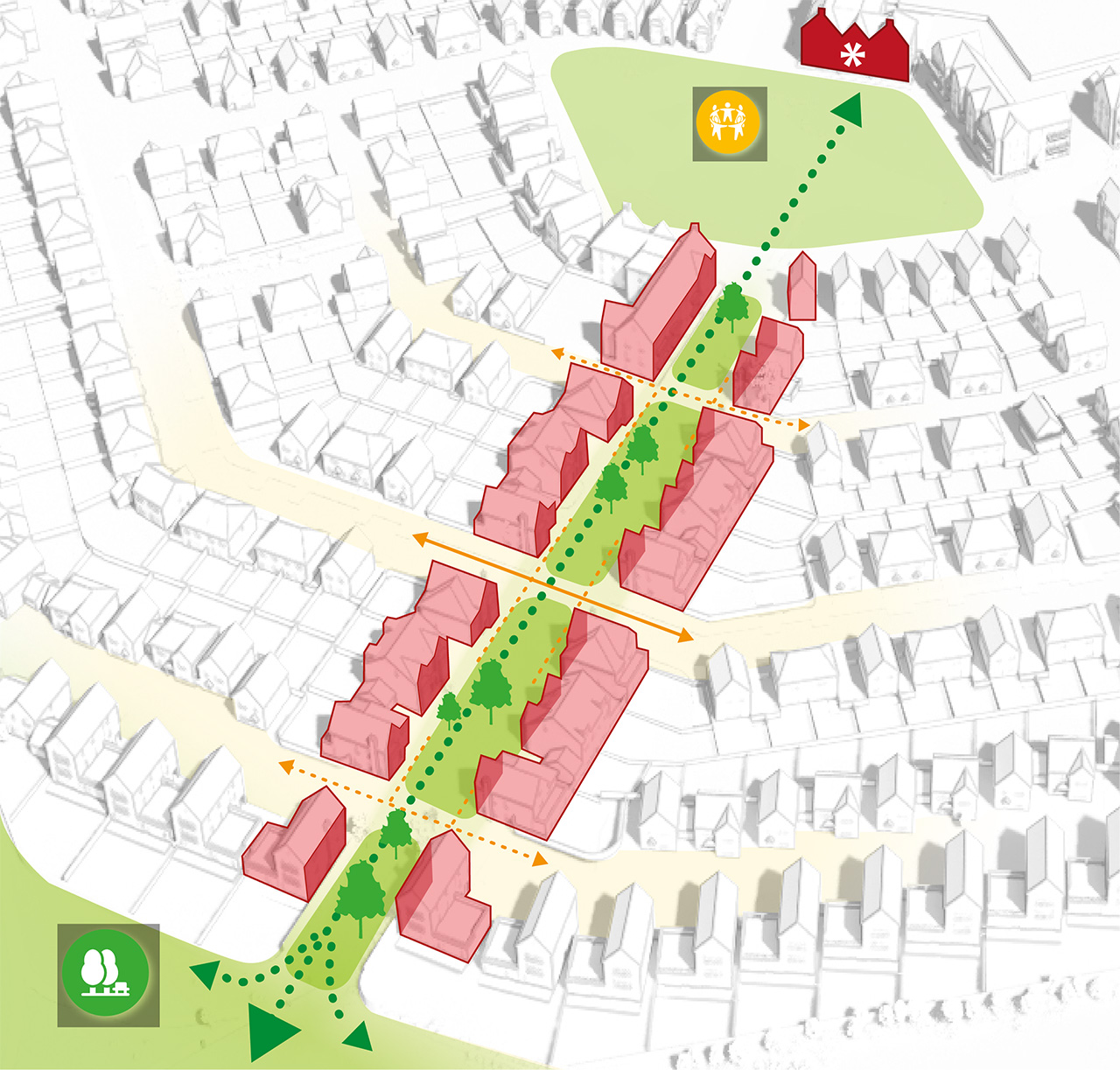
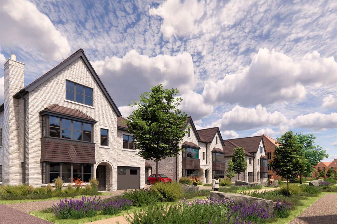
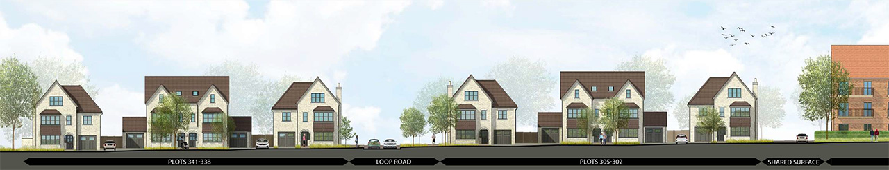
5. The suburban village streets formed around the main loop route
The loop route forms a more formal, suburban street character at the heart of the development. A tree-lined layout with wide verges, footways and defensible planting creates a structured, attractive street scene.
Two-storey homes are arranged in clear, ordered frontages, with corner houses positioned to aid wayfinding and natural surveillance. Planting is predominantly decorative but chosen to support biodiversity, with a mixture of hedges and railings defining front gardens.
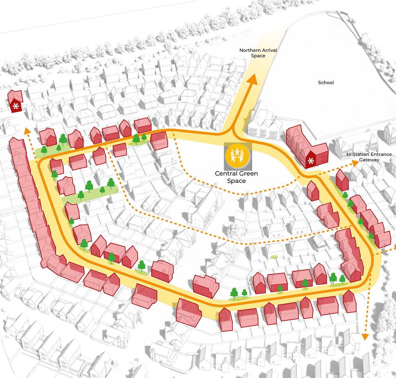
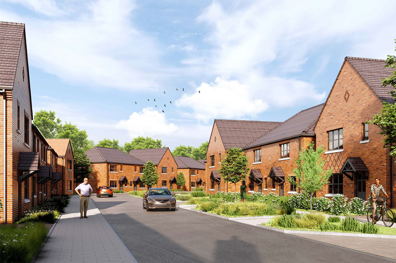
6. The residential shared surface streets
Smaller shared-surface streets create intimate clusters of homes set away from the main movement routes. Their character varies across the site: in the north, white-boarded homes are introduced alongside red-brick pairs, while in the south-east the homes have a looser, more varied building rhythm and a warmer brick palette. These areas use staggered layouts, mixed rooflines and varied materials to form relaxed, neighbourly spaces.
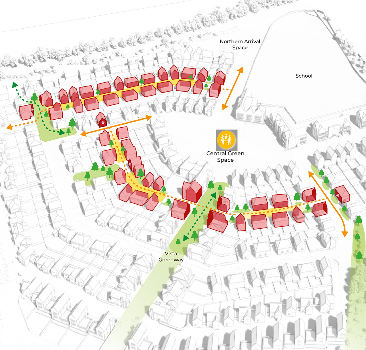
7. Ray Brook view landscape edge
At the south-west corner, the Vista Greenway opens into a space overlooking Ray Brook and the surrounding countryside. Three-storey homes with roof-terrace elements create gaps that allow filtered views and maximise daylight.
Stepped frontages and triple-aspect homes animate the streetscene, while a pedestrian route along the woodland edge connects walking trails west–east. Planting provides a natural buffer between homes and the footpath.
8. The rural edge along the woodland and Bradmore lane
The northern and western edges respond to the mature woodland and existing trees along Bradmore Lane. Informal, shared-surface routes create pedestrian and cycle connections and linkages to public rights of way.
Homes vary in frontage, materials and height, creating a looser development edge. Red brick, white boarding and tile-hanging feature alongside chimneys, bay windows and dormers, establishing a broken, varied silhouette against the woodland backdrop.
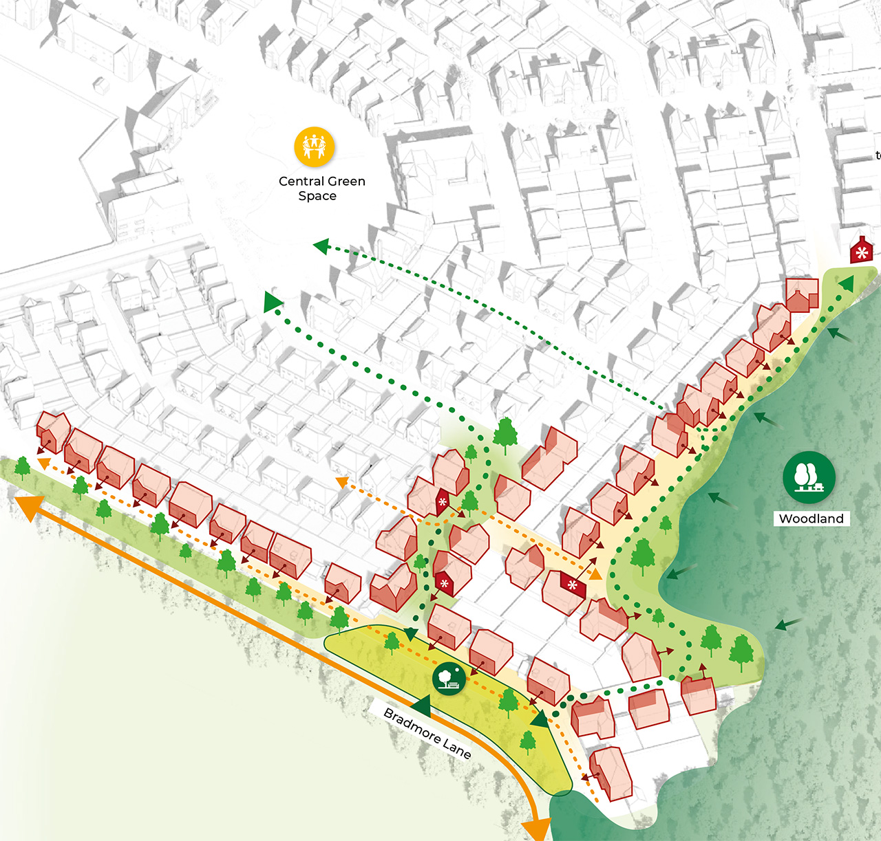
9. The south-eastern open space and play area and eastern corner framed by the hedged public right of way and the railway boundary
A series of apartment buildings address the eastern edge, overlooking new natural open space and framing informal areas with playful gable arrangements. A larger landmark building anchors the southern edge near the play space.
Behind the hedged public right of way, houses extend the urban grain and shape smaller pocket spaces. The open space provides a naturalistic landscape with play features, biodiversity enhancements and water-management areas, including wildlife ponds, while new planting along the railway creates enclosure and strengthens the rural edge character.
Design
Proposals that reflect the surrounding context
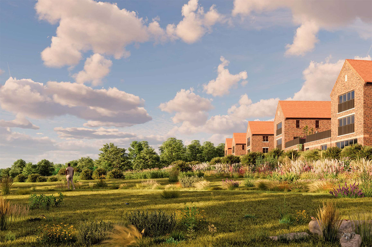
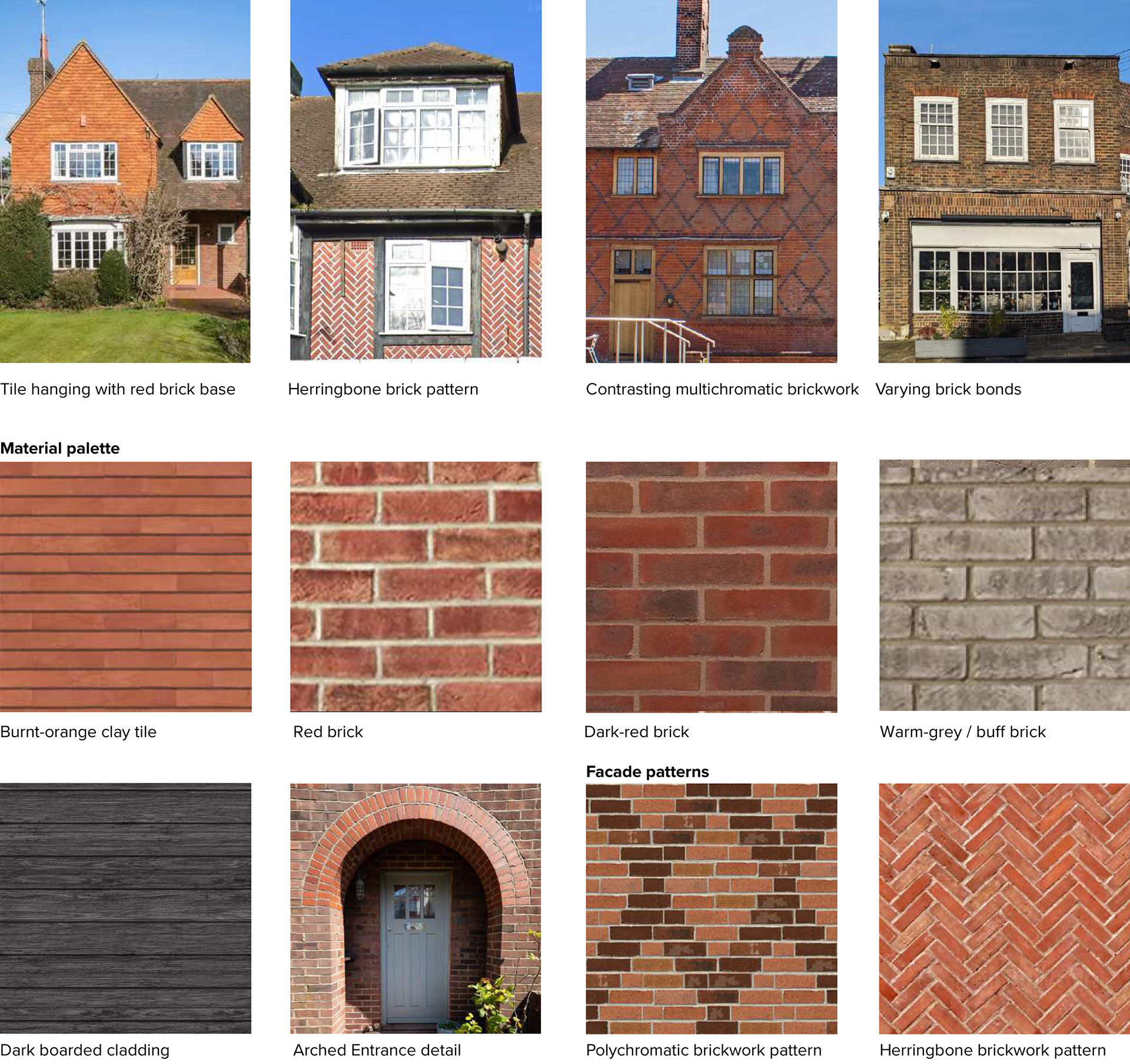
The proposals have been designed to ensure that they reflect their surrounding context. The sites main entrances toward the northeastern and eastern boundary will be more formal in their structure with key building providing wayfinding and legibility.
The proposals become less formal as they transition towards the open countryside and woodland edge towards the northern, southern and western boundaries, using more natural materials and colours with detached homes.
Key features will include:
- Frontage gable details
- Brick patterns and contrast
- Tile hanging details
- Bay windows
- Distinctive grouping of windows
- Typical 1930s entrances
Each home will be fitted with an air source heat pump which is more sustainable than conventional gas, providing energy enhancement to the home. All homes will be built to exceed building regulation targets.
The primary school
Land for a new primary school
The proposals include the provision of land for a new on-site two-form entry primary school, including Early Years provision.
The new primary school will provide education facilities to prospective new residents as well as contribute to wider need for school places in the local area.
After much discussion, the school land has been located in the northeastern corner of the site. This is primarily due to this area being well located for pedestrians and cyclists, preventing additional traffic entering the site and ensuring that the new community asset is located close to the existing community. When required, the land will be transferred to Hertfordshire County Council who will appoint a contractor to design and build the new school. Discussions remain ongoing with the County Council.

Vehicular access
A new access point off Bradmore Lane
The proposed development will be accessed via a new access point off Bradmore Lane at the northeast of the site.
The informal, rural character of the landscape at the junction will provide a transition from the rural northern edge into the new development and leads directly towards the proposed new central green.
The design and location of the junction has been subject to discussions with the Hertfordshire County Council Highways team.
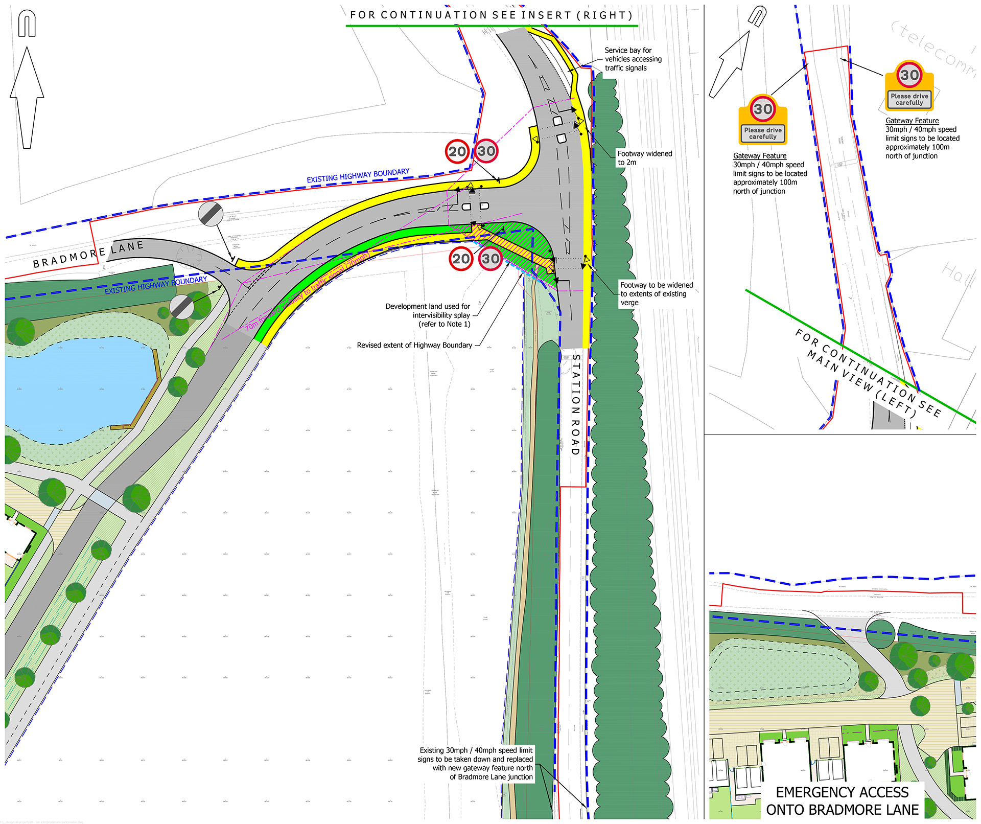
 Existing kerb line
 Proposed kerb / edging line
 Visibility splay
 Existing highway boundary
 Proposed highway boundary
 Carriageway
 Footway
 Verge / landscaped area
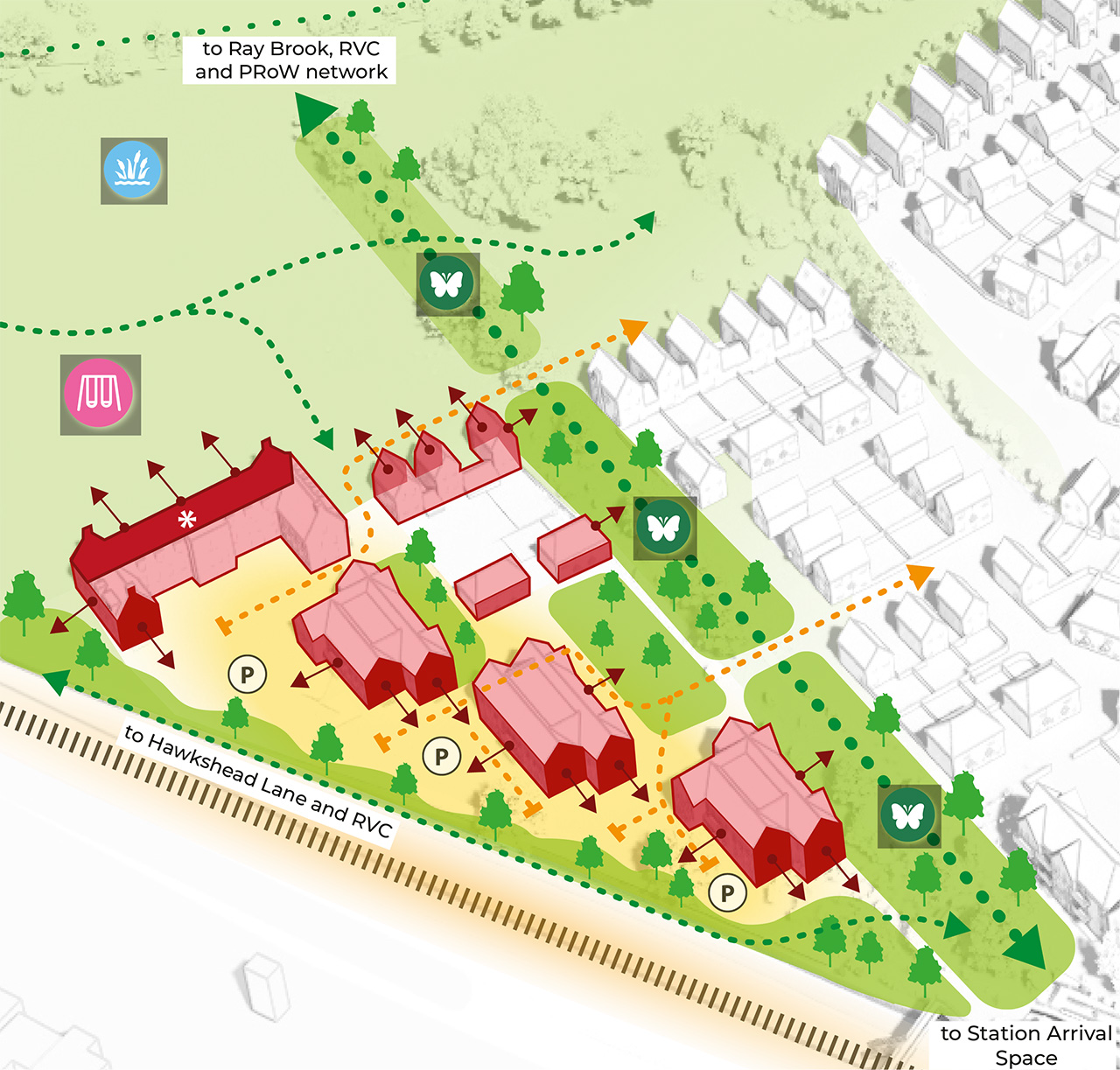
Active travel
Reducing the reliance on cars
The development is designed to make walking and cycling safe, easy, and enjoyable. All streets are 20mph, with direct connections throughout the site to encourage sustainable travel.
A dedicated cycle path will run from Bradmore Lane to the village centre, passing the railway station and linking to the proposed new cycle and footbridge. Shared pedestrian–cycle paths provide additional direct routes to the central green space.
The central green spine includes a pedestrian route separated from traffic, with links to the woodland edge, creating attractive walking routes through the site. Existing public rights of way are retained and enhanced, maintaining connections to the wider network of paths leading to Ray Brook, Hawkshead Lane, and the Royal Veterinary College campus.
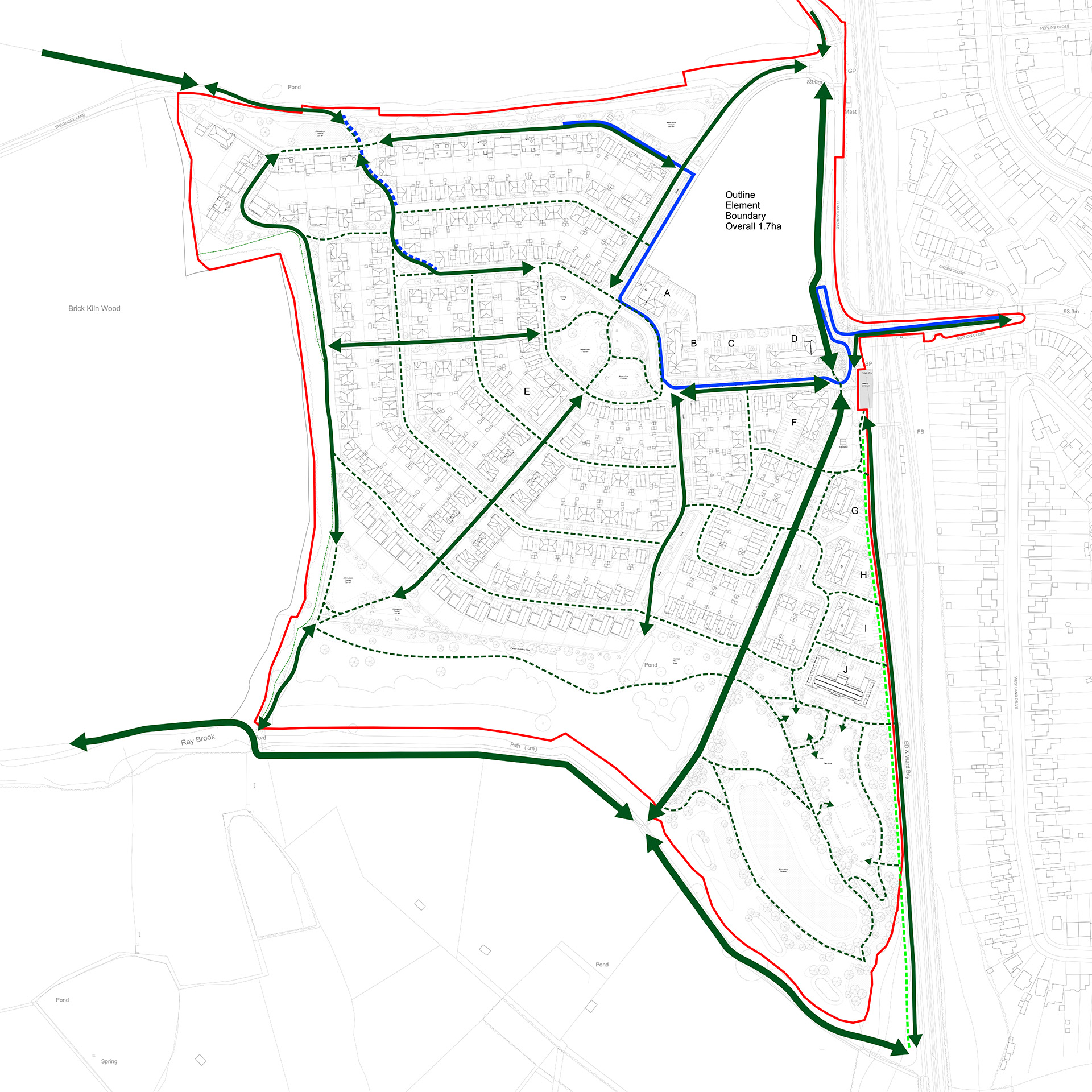
 Red line boundary
 Primary pedestrian routes
 Secondary pedestrian routes / shared surfaces
 PRoW
PRoW Dedicated cycle route
 Shared cycleway / footway
 4m zone for potential future LCWIP route should it be required
New pedestrian / cycle bridge
A new connection for the site
A key part of the proposals is a new connection between the site, railway station entrance and village in the form of a new pedestrian and cycle bridge over the railway line.
This will replace the existing pedestrian bridge providing a wider and more suitable connection into Brookmans Park for both new and existing residents.
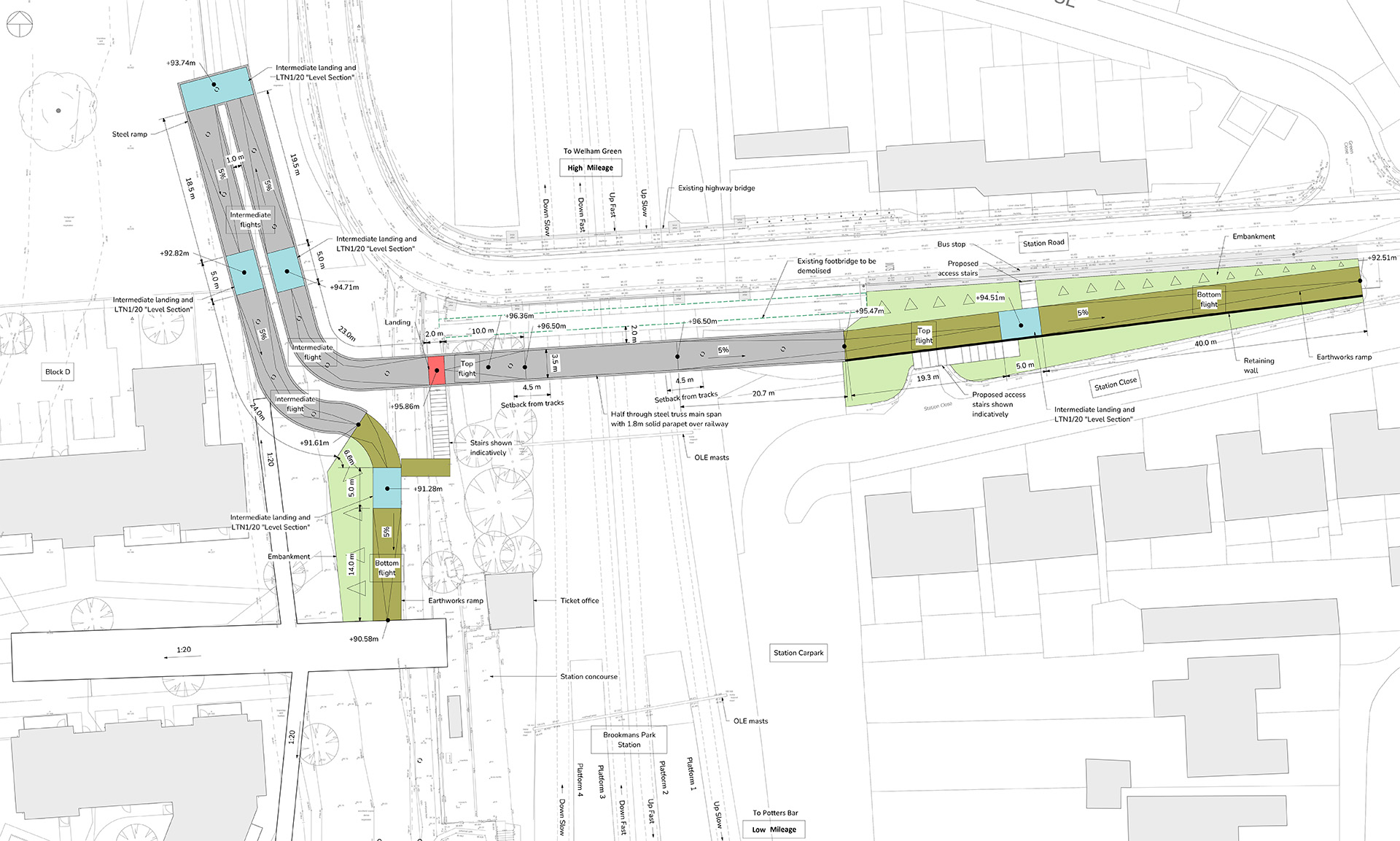
 Main span, ramp and access stairs
 Intermediate landing and LTN1/20 “Level Section”
 Eathworks ramp
 Embankment
 Landing
Landscaping and open spaces
A range of new green infrastructure
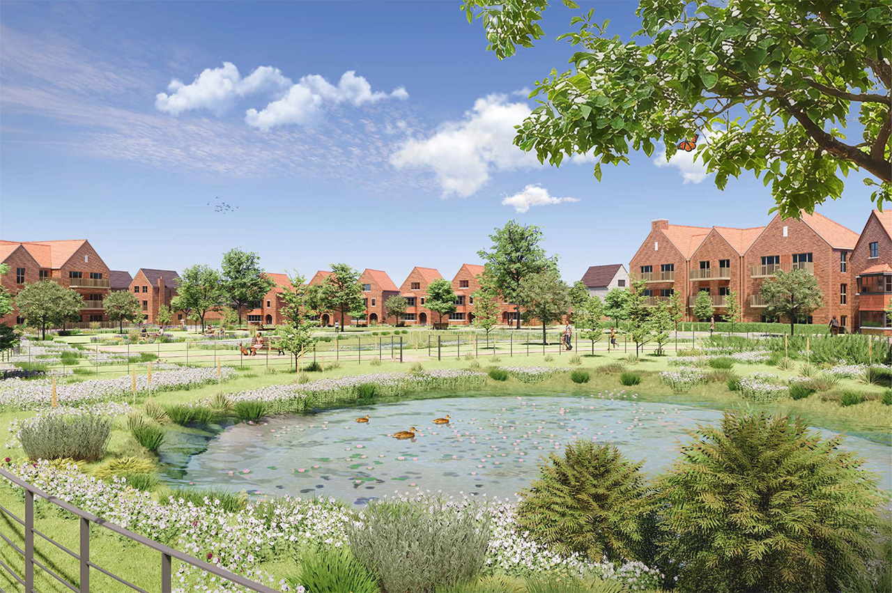
The development is designed to enhance biodiversity and create high-quality green spaces for both residents and wildlife. New habitats will include wildflower meadows, native shrubs, hedgerows, ponds and extensive tree planting.
The south-eastern corner of the site will be transformed into an ecological area, connecting to the ancient woodland to the west and other woodland to the south-east, forming a continuous wildlife corridor.
Existing habitats, including species-rich hedgerows, ponds, grassland, and trees, will be retained and enhanced. A buffer along the western boundary will protect the ancient woodland, while new hedgerows and wildflower meadow strips will strengthen connectivity for wildlife across the site. On-site measures are designed to benefit birds, bats, reptiles, amphibians, and small mammals.
As part of the proposals, a Biodiversity Net Gain (BNG) assessment has been undertaken to ensure the scheme delivers measurable benefits for wildlife. On-site measures achieve over 10% gains in watercourse and hedgerow units, with additional habitat units secured off-site via a habitat bank.
The landscaping strategy integrates a range of features including:
- Integrating and enhancing existing landscape and ecological features, including mature trees, hedgerows and habitats, while responding positively to the local landscape character of the Mimmshall Valley.
- Creating a coherent, multi-functional network of green spaces that forms a strategic green framework across the site and connects to the wider countryside and public rights of way.
- Delivering a permeable, accessible and legible public realm with a clear hierarchy of routes that prioritises pedestrians and cyclists and encourages active travel.
- Strengthening connections within the site and providing new pedestrian and cycle links to the existing Brookmans Park settlement and surrounding movement network.
- Designing safe, attractive and inclusive public spaces with natural surveillance and a clear distinction between public and private areas.
- Establishing a variety of landscape character areas, ranging from a more formal urban character near the railway station and central open space to a looser, more informal landscape at the woodland edge and southern boundary.
- Integrating a comprehensive Sustainable Drainage Systems (SuDS) strategy, including attenuation ponds and swales, to manage surface water while delivering amenity and biodiversity benefits.
- Incorporating play spaces, natural play and informal open space throughout the site.
- Ensuring the development is well integrated into the surrounding landscape and contributes positively to local views and townscape.


Drainage
A surface water drainage strategy for the site
The developable area of the site is located in a low-risk Flood Zone 1 area, meaning that the site is at a low risk of fluvial and tidal flooding. There is an area of high-risk Flood Zone 3 located to the south of the development area associated with the watercourse, however no development is proposed in this area.
The Environment Agency surface water flood maps identify that the majority of the site is at a very low risk of surface water flooding; however, there are areas which currently experience occasional flooding (associated with the existing ditch network through the site). The implementation of the proposed surface water drainage strategy will capture, and control surface water generated on-site, removing the risk identified.
Proposed Surface Water Drainage:
- The proposed surface water drainage strategy will use sustainable urban drainage systems (SuDS) to capture, control and release water generated on-site, back to pre-development greenfield rates. Infiltration to the ground has been identified as an unsuitable method of discharge; therefore, it is proposed to discharge at pre-development greenfield rates to the respective existing ditch / watercourse to the north and south of the site, respectively.
- The system is designed to manage severe weather that happens very rarely, such as 1-in-100-year storm event and to account for climate change.
- The proposed SuDS features include a variety of storage options: attenuation basins, swales, and permeable paving to provide storage during rainfall events, treatment, amenity, and biodiversity benefits.
Proposed Foul Drainage:
- It is intended that foul effluent will discharge into Thames Water’s existing foul drainage network.
- The foul drainage system will naturally flow to the south of the site before discharging to the existing Thames Water network.
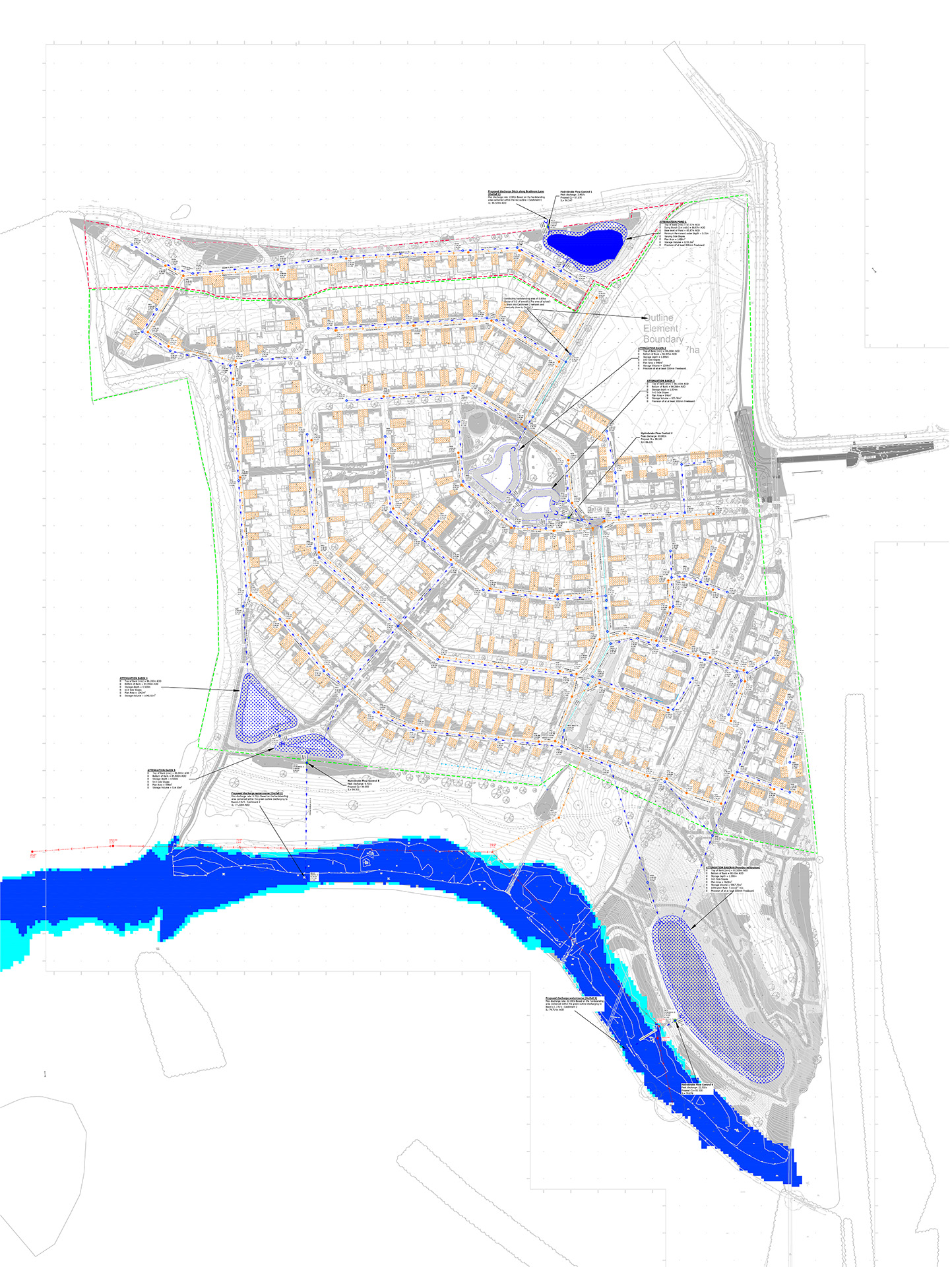
 Northern catchment
 Southern catchment
 Proposed surface water sewer and manhole
 Proposed foul water sewer and manhole
 Existing Thames Water foul sewer and manhole
 Proposed swale under-drain
 Proposed attenuation pond
 Proposed attenuation basin
 Flood zone 2 extent
 Flood zone 3 extent
 Proposed headwall
 Proposed hydrobrake
 Permeable paving
 Proposed private surface water inspection chamber and sewer
Construction management plan
Efficient and safe construction with minimal disruption
If planning permission is granted, a Construction Management Plan will be required to be approved before development starts. That will detail how the construction will be carried out efficiently, safely and with minimal disruption to the surrounding community and environment. It will include:
- Proposed working hours: Construction work and site deliveries will take place between the hours of 8am to 6pm (Monday to Friday) and 8:00am to 1:00pm (Saturdays), with no construction work on Sundays or public holidays.
- Deliveries: All deliveries will be via Station Road/Bradmore Lane. Drivers will be instructed not to use Warrengate Road, Hawkshead Lane (west of the junction with Bluebridge Road) and Bradmore Lane west of the site access. Signage will be displayed directing construction traffic to/from the site and traffic movements into/out of the site will be controlled by a trained banksman/signaller. Site vehicles will not be allowed to park outside the site, unless in an emergency. The site gates will be set back far enough to allow a lorry to wait off the road until the gate is opened. Construction traffic will not use privately owned roads.
- Noise and dust control: Measures will be in place to reduce the impact to the surrounding area. This will include noise barriers, water suppression for dust, and restricted use of loud machinery during early hours.
- Waste and environmental management: Strategies for waste disposal, recycling, and protecting local wildlife and ecosystems will be established for the site.
- Site security: On-site safety measures and security will be in place to prevent unauthorised access.
- Communication strategy: Regular updates will be provided to residents and a point of contact for complaints or queries will be established before work begins on site.
- Emergency procedures: Contingency plans will be in place for dealing with incidents such as spills, accidents, or severe weather.
The construction period will run for approximately 7 years, subject to sales rates.


Supporting the RVC
Training the vets of the future
The RVC is a world-leader in the education and training of veterinary, veterinary nursing and biological science students and is currently the top ranked veterinary school in the world for the fourth consecutive year.
The RVC has a globally significant education, clinical and research centre at the Hawkshead Campus employing around 760 people.
Being a long establish part of the local community, the RVC is committed to ensuring development of its landholding is of a high quality and that placemaking responds directly to the needs and aspirations of the local area, leaving a lasting legacy.
By bringing forward this development, the RVC will be able to underpin its long-term planning to continue its 200+ year legacy of delivering world-class education, clinical service and research as a world-leading institution and employer in Welwyn Hatfield.
In Welwyn Hatfield, the RVC is keen to support the Council in achieving its economic, social and environmental objectives and Herts LEP in its goals for life sciences. Critical to those roles is addressing the local housing need in a way which is mutually beneficial to the RVC and the broader community.

Timeline
Overview of the proposals process
June 2024
Launch of first round of consultation
January 2025
Launch of second round of consultation
January 2026
Submission of planning application