The site
Site location
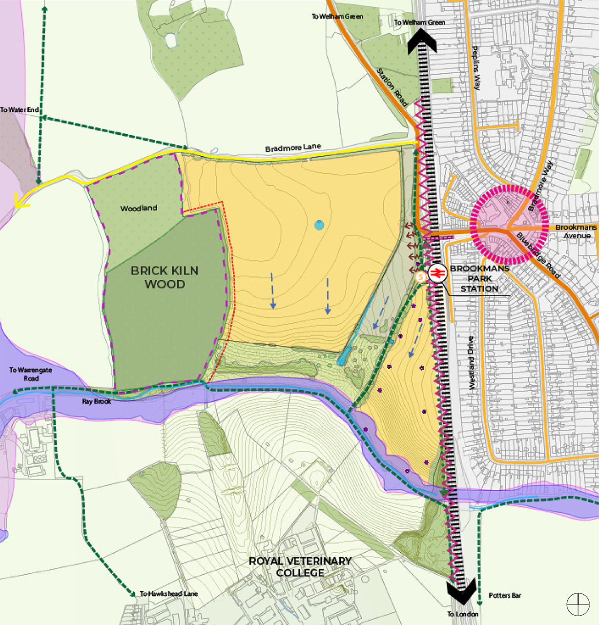
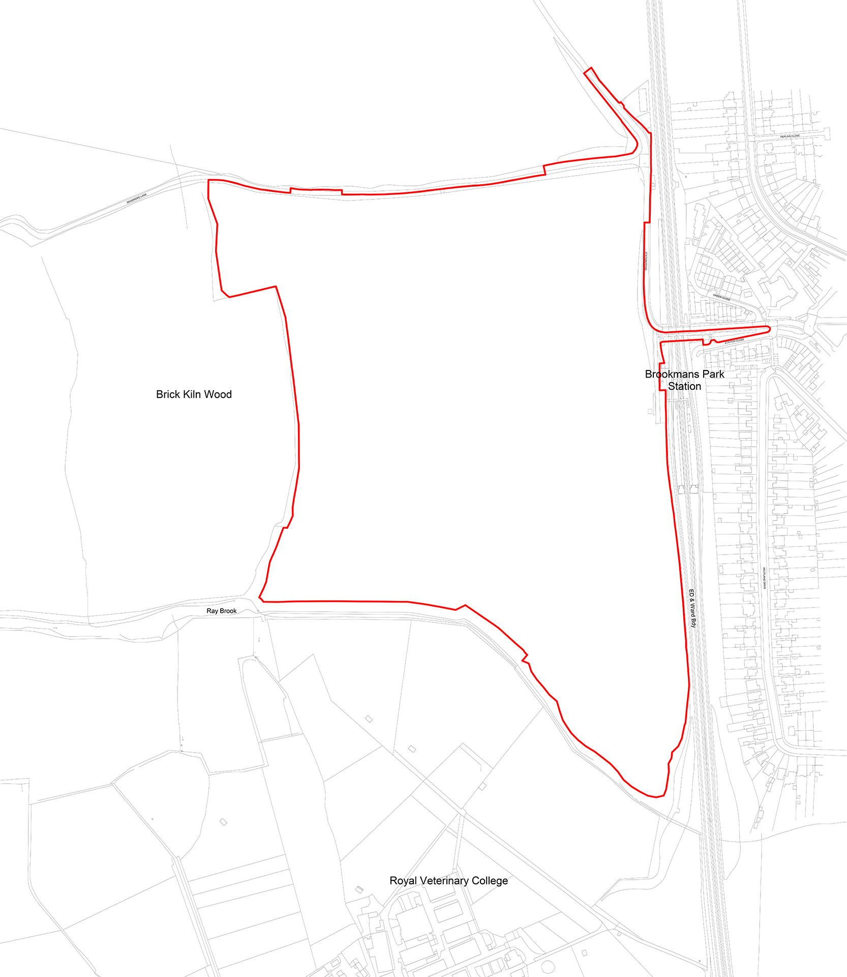
The site is located on the western edge of Brookmans Park.
The location of the site benefits from access to the wider public transport network including the railway station and local bus stops to the wider area.
The site is bordered by ancient woodland to the west, a rural country lane to the north, the East Coast Main Line to the east and Ray Brook, paddocks and pastures associated with the Royal Veterinary College towards the south.
Brookmans Park village centre to the east is within 800m of all parts of the site.
There are a number of existing footpaths around the site including a north-south route along the eastern boundary, and an east-west route along the southern boundary.
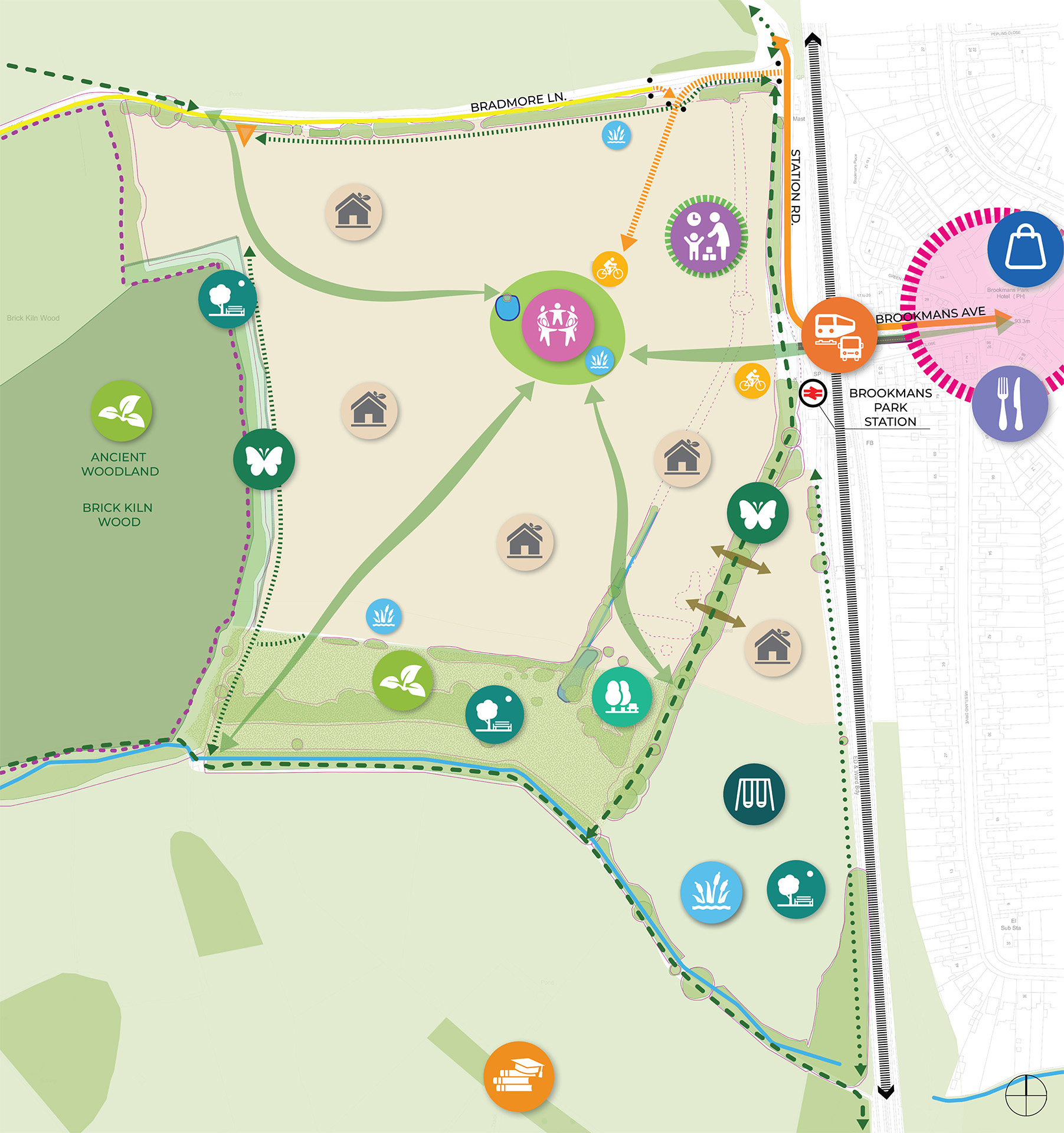
In order to improve connectivity and accessibility with Brookmans Park and the railway station, the proposals include a new cycle and pedestrian bridge over the railway line.

Welwyn Hatfield Local Plan (2016 – 2036)
Part of the local plan
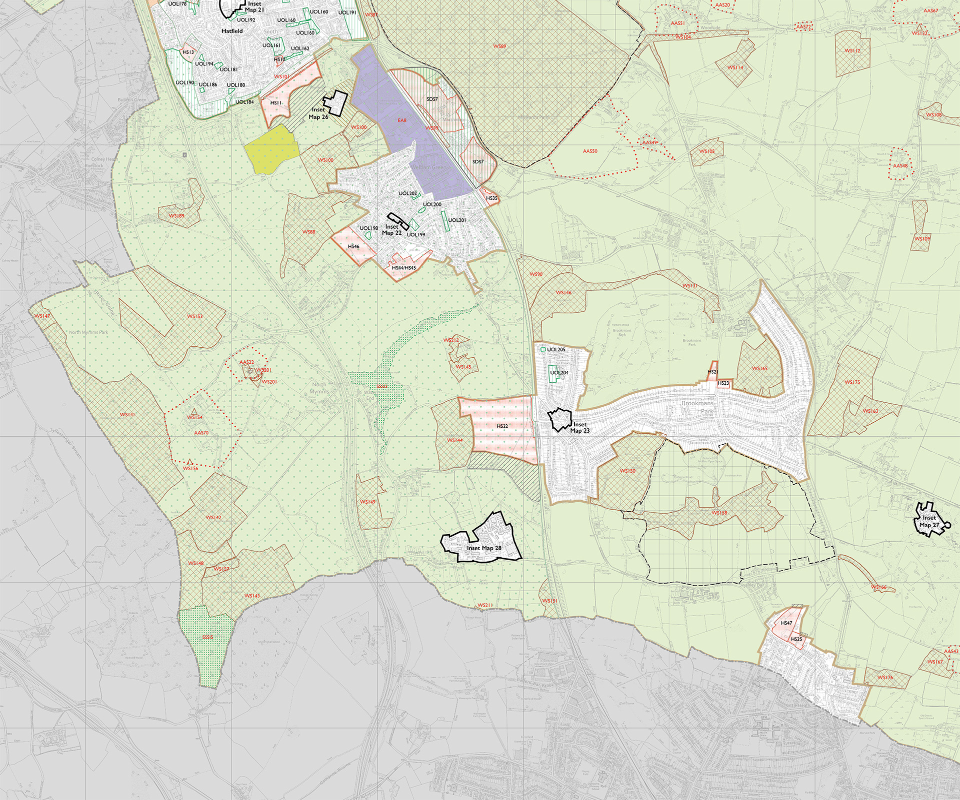
The site is allocated in the adopted Welwyn Hatfield Local Plan 2016 – 2036 and is referred to as site ‘HS22’ under Policy SADM 31. This allocation deems the site suitable for residential development.
The Local Plan identifies that in excess of 15,000 new homes are required by 2036 to support the Council’s economic aspirations in a sustainable way. This site is allocated by the Council to help meet those needs.
The Council’s most recent research (2015) showed that there is a backlog of affordable housing need of over 1,000 homes and that each year there is newly arising demand of over 500 affordable homes. The site will also help meet those needs by delivering 35% of the homes as Affordable Housing.
By developing this site, it will help the Council deliver on its obligations in the Local Plan to deliver housing for the borough, alongside providing local infrastructure for residents of Brookmans Park.


Strategic framework
Considering the wider site
The Strategic Framework sets out the overarching principles that have informed the detailed design development of this site in order to support the delivery of high-quality sustainable homes, considered landscaping and active travel links to support a balanced community at Brookmans Park that meets the agreed objectives and maximises the benefit of the allocation.
The Strategic Framework was formally endorsed by councillors in November 2024 and the overarching design principles include:
- Creating a landscape-led, permeable scheme which connects to the wider community and existing movement network.
- Establishing a clear hierarchy of routes to enable legibility of movement throughout the proposed development.
- Prioritise pedestrian and cycle movement, enhancing active travel.
- Provide natural surveillance, creating open spaces that are safe and pleasant, with clear definition of public and private realm.
- Develop a variety of character areas across the site to create interest and establish a sense of place.
- Consider a tighter, more formal urban grain close to the railway station and surrounding the central open space; and a looser, informal urban grain towards the western woodland edge with open landscape to the south.
- Make efficient and effective use of land removed from Green Belt for housing.
- Accent buildings and key corners should be considered when developing the masterplan in order to define key spaces and to act as markers along movement routes.
- Consider introduction of carefully designed and framed views towards the development from key points in the surrounding area.
- Maximise opportunities to enhance ecology and biodiversity.
- Enhance shrub and tree planting, introducing additional boundary planting where possible, while still allowing selective views into the development.
- Locate the two-form entry primary school land where it enables easy access for pedestrians and cyclists and supports its role as a community hub.
- A comprehensive SuDS strategy integrated with the landscape design.
- Enhance connections to the wider countryside.


Key constraints
Site analysis
Site analysis studies have identified a series of constraints. These include:
- The ancient woodland (Brick Kiln Wood) requires a minimum 15m buffer.
- Significant level changes at the southern extent of the site and between the site and railway station.
- There is an area of grassland and scrub along the southern boundary which is good quality and requires integration into proposals.
- A series of 11KW electricity lines run through the south-eastern field.
- Access and maintenance close to the station entrance.
- Potential for noise pollution from the East Coast Main Line.
- Public rights of way run through the site and along the eastern and southern boundaries.
- The local plan identifies a key view from the footpath to the south close to Hawkshead Lane.
- Existing water bodies and water courses.
- Existing hedgerows cross the site.
- The rural character of Bradmore Lane needs to be retained.